It’s very hard to get decent observed wind data for the UK (and most countries, I imagine), so I was intrigued when I found a 1km resolution database of wind data freely available online. You can download ‘GIS ready’ data on that page, or enter a grid reference in an online tool.
This is an old wind database with a slightly mysterious history, but they do offer a bit of information:
The database was originally developed the Department of Trade and Industry (DTI) at some point before 2001, and as far as is known, the data that was used to build up the database dates from the period approximately mid-1970s to mid-1980s.
So far, so good. Except the ‘GIS ready’ ASCII files aren’t very GIS ready, they need a bit of prep. There is some documentation on this process (local copy here), but the instructions are actually wrong – you get a mangled dataset when you import it into a GIS. These incorrect instructions are as follows:
Open your ASCII file in Excel as semi-colon delimited data, delete header line and first column and then save as a CSV comma delimited file. Open this in a text editor such as Wordpad and Replace the ‘semi-colon+space’ with a ‘comma’ and then delete carriage return at the end of the file.
What we really want is someone to fix the instructions, convert the data to a better format and put the data online… well, that’s what I did:
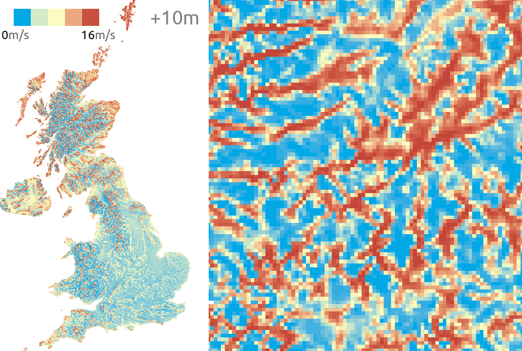
You can see the data now looks right – a nice UK mean annual wind dataset at 1km resolution. I’ve zipped up the three datasets (10m, 25m and 45m above ground) here:

The original reason for getting this data was helping a teacher with a lesson on wind turbines. You can see that wind turbines can get a lot taller than 45m, but it’s a decent enough dataset for the purpose.
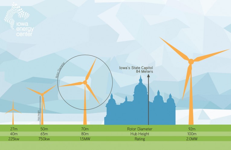
A nice graphic showing various wind turbine heights. © Iowa Energy Center
It’s probably not necessary to detail the methods, but here was my process to fix the .asc files so they could be imported into a GIS. The s: / r: code is a search and replace, performed using TextPad with the regular expression field ticked:
s: ";1"       r: "; 1"

s: "\(  0,"       r: "\t\t\tnl\n\(  0,"
Then delete the column and header.
s: "\n"       r: " "

s: " \tnl "       r: "\n"

s: "; "       r: " "

s: ";"       r: ""
Then add this to the top of the file:
ncols 700

nrows 1300

xllcorner 0

yllcorner 0

cellsize 1000
And finally delete the space at end of file – all done.